


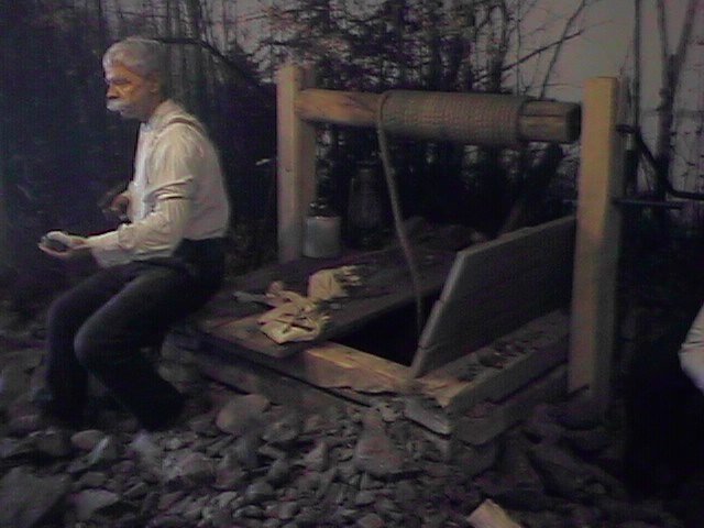
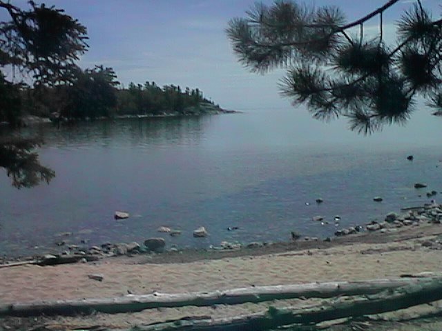
 Visited the local museum and wandered around town. The photo is from the
museum and shows a diorama of gold mining in the area. The town is located
on picturesque Lake of the Woods and has also been a site of summer cottages
of the wealthy. The railroad came through in the late 1800s and
then the trans-Canada highway was constructed through here in 1932.
Visited the local museum and wandered around town. The photo is from the
museum and shows a diorama of gold mining in the area. The town is located
on picturesque Lake of the Woods and has also been a site of summer cottages
of the wealthy. The railroad came through in the late 1800s and
then the trans-Canada highway was constructed through here in 1932.
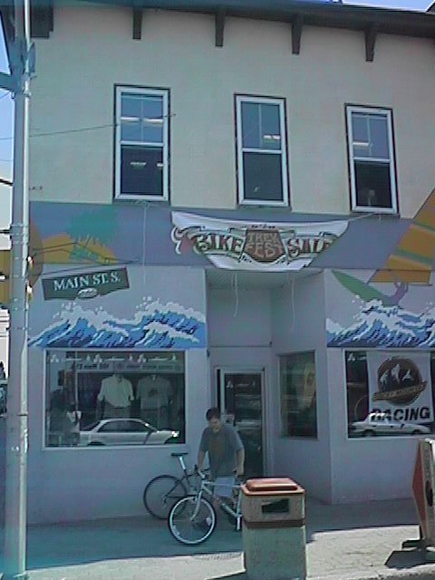 Stephen from Waves cycle shop had my wheel done in the morning. Great!
Hopefully wheel #4 will last a little longer. While I could have left
in the afternoon, I decided to take a full rest day.
Stephen from Waves cycle shop had my wheel done in the morning. Great!
Hopefully wheel #4 will last a little longer. While I could have left
in the afternoon, I decided to take a full rest day.
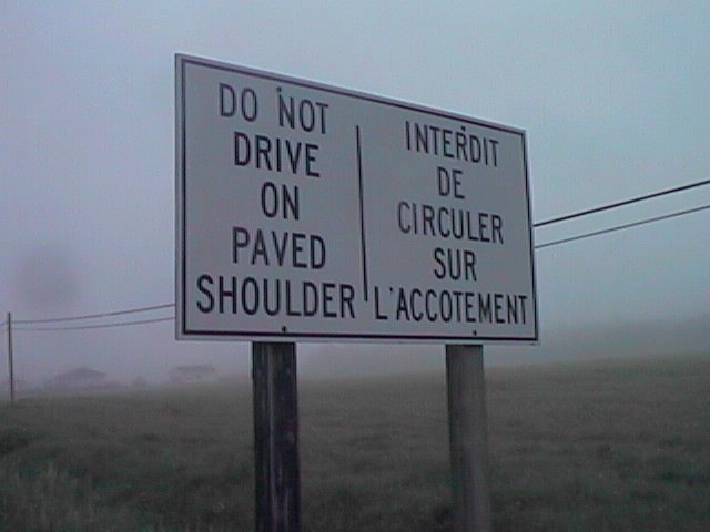
On the internet, I had seen negative reports about the direct route via
Dryden to Thunder Bay (narrow, no shoulders, road construction, many trucks,
worst five cycling roads in Canada,...)
I also consulted with the tourist bureau. From here the plan will be to
first head south to Fort Francis and then across to Thunder Bay. The tourist
agency described this route as "more scenic and only an hour longer..."
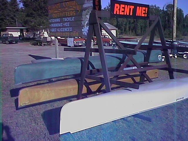
![]()
 On the road again! Cool morning air as I cycled out of Kenora. At mile 12,
the road split. I chose to take route #71 to the south. This route started
out with nice wide 3 ft shoulders. They became intermittent after half a
dozen miles and went away after that. The route also became somewhat patchy
and rough. However, overall today's route was reasonable and far better
than the rumors of the alternative.
On the road again! Cool morning air as I cycled out of Kenora. At mile 12,
the road split. I chose to take route #71 to the south. This route started
out with nice wide 3 ft shoulders. They became intermittent after half a
dozen miles and went away after that. The route also became somewhat patchy
and rough. However, overall today's route was reasonable and far better
than the rumors of the alternative.
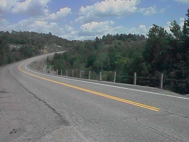
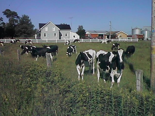
The road has twists and turns and occasionally climbs over a low hill. My shifting got some exercise today as I adjusted to the little hills. There were many small lakes along this way. Also many small "camps". You could tell this was a resort destination for those wishing to fish, or spend a week relaxing at the lake.
 Made good time this morning. Stopped at the first restaurant which was
mile 47 in Sioux Narrows. Sioux Narrows was right along Lake of the Woods.
The entire next stretch was also along the lake, though rarely close
enough to actually see. Many "camps" and other resorts between Sioux Narrows
and the next town of Nestor Falls. Apparently good fishing for Walleye,
Northern Pike and Croppies. I heard, "June is a time for hard core fisherman,
it shifts more to families in July and August".
Made good time this morning. Stopped at the first restaurant which was
mile 47 in Sioux Narrows. Sioux Narrows was right along Lake of the Woods.
The entire next stretch was also along the lake, though rarely close
enough to actually see. Many "camps" and other resorts between Sioux Narrows
and the next town of Nestor Falls. Apparently good fishing for Walleye,
Northern Pike and Croppies. I heard, "June is a time for hard core fisherman,
it shifts more to families in July and August".
After Nestor Falls, several rolling hills, but suddenly the land levels out.
There are several areas of open pastureland. Farmland again. Fortunately,
winds were from the north today, i.e. tailwinds. Passed the 100 mile mark
before reaching the junction of 71/11. At this point, the top surface of
the road was torn up in preparation for re-grading. Yuck! Cycled on this
for four miles before reaching Emo and a good stopping point for the day.
![]()
The road mostly didn't have shoulders, but traffic was fairly light. The first fifty miles had occasional deep cracks that were a pain to cycle over, hopefully not wheel breakers. After that the surfacing got better. I did encounter my first rude trucker. He was right behind me waiting to pass. As he passed, he decided to veer right, forcing me off the road and into the shoulder. He corrected afterwards, so it was pretty clearly deliberate. Sigh.
Cycled 20 miles before breakfast at Fort Frances. At 9000 people, the largest town around. Had an industrial feel to it with a smell of paper mills, lots of trucks and poor roads. Stopped briefly at the tourist office across from the bridge to International Falls, Minnesota. Closest I'll be to the US for a while.
 Timber. Many log trucks out on the highways today. Mostly carrying
these 8ft long sections of logs. Also periodically the road has a
"Pulp, Vehicle Inspection Turnoff". The other big industry around here
appears to be tourism, with about one in three cars either carrying a
canoe or towing a boat.
Timber. Many log trucks out on the highways today. Mostly carrying
these 8ft long sections of logs. Also periodically the road has a
"Pulp, Vehicle Inspection Turnoff". The other big industry around here
appears to be tourism, with about one in three cars either carrying a
canoe or towing a boat.
After Fort Frances, the road crosses over Rainy Lake before going through
deep forest for the rest of the way. Lunch at Mine Centre at mile 63.
After that, I would pass the occasional "resort". Got the impression these
were the sorts of places one would spend a week fishing or canoeing.
Got into Atikokan around six, long day but good miles.
![]()
 Highway 11 continued past numerous canoe camps and resorts. Passed
Quetico Provincial Park at mile 24. There was a nice visitor center
here. Apparently, the park is mostly a canoe take off point, with many
lakes and rivers.
Highway 11 continued past numerous canoe camps and resorts. Passed
Quetico Provincial Park at mile 24. There was a nice visitor center
here. Apparently, the park is mostly a canoe take off point, with many
lakes and rivers.
Not many towns today, breakfast at mile 16. Another place at mile 24 and
then nothing until mile 60. Light tailwinds helping along the way.
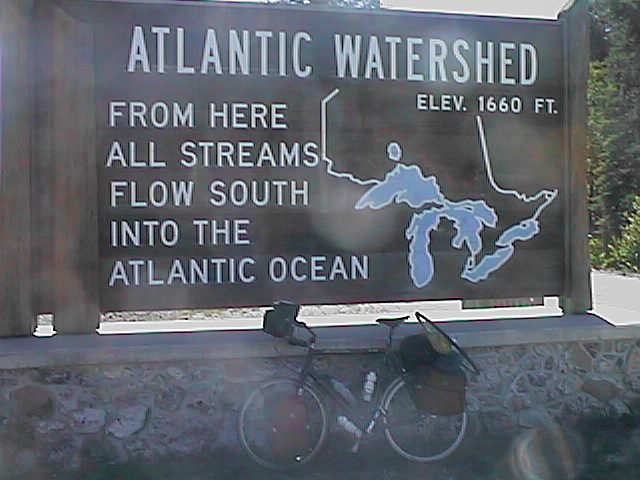
A number of gently rolling hills. On the top of one at mile 43, this sign
marking the division between Atlantic and Arctic river drainages. Yeah!
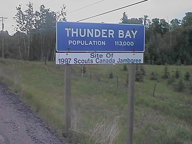
Passed over the time zone boundary to Eastern daylight time. Even with
the new time, it was only 4pm, but decided to stop for the day and tackle
Thunder Bay tomorrow. Here the road rejoined the trans-Canada highway (TCH).
Almost immediately, more traffic include many trucks (called "transports"
up here).
![]()
 Easy day of cycling today. Decided to make it a short day to Thunder Bay.
I was back cycling along the TCH and was surprised at the number of
transports on the road at 6am on a Sunday morning. Fortunately, there
wasn't too much other traffic so they could give me plenty of room.
Easy day of cycling today. Decided to make it a short day to Thunder Bay.
I was back cycling along the TCH and was surprised at the number of
transports on the road at 6am on a Sunday morning. Fortunately, there
wasn't too much other traffic so they could give me plenty of room.
 Saw one moose shortly before mile 12. At this point, I took route 102
across to #17/#11. This was 11 miles shorter, though reportedly much
hillier. Hills weren't too bad. In this stretch of road were many small
little houses along the road. I believe they were used to shelter school
children while they were waiting for the bus. It started lightly raining
by mile 25. I stopped in at a truck stop and asked a woman about the
road ahead to "the soo". Apparently some large hills and some construction.
She asked me, "what are you pulling?" and looked a little strangely when
the response was "a bicycle". Stopped at mile 33. Rain showers coming
down made that a bit easier.
Saw one moose shortly before mile 12. At this point, I took route 102
across to #17/#11. This was 11 miles shorter, though reportedly much
hillier. Hills weren't too bad. In this stretch of road were many small
little houses along the road. I believe they were used to shelter school
children while they were waiting for the bus. It started lightly raining
by mile 25. I stopped in at a truck stop and asked a woman about the
road ahead to "the soo". Apparently some large hills and some construction.
She asked me, "what are you pulling?" and looked a little strangely when
the response was "a bicycle". Stopped at mile 33. Rain showers coming
down made that a bit easier.
Today was halfway point, 45 days on the road, with 45 cycling days left.
Total mileage so far is 3198 miles. I anticipate my route will take me
another ~2750 miles.
![]()
 Light drizzle when I woke up, though it stopped by the time I started
cycling. Unfortunately, this did mean the road was wet and passing
transports would kick up a fine mist. The TCH road surface was nice and
smooth, though the shoulders were only about a foot wide in most places.
Occasionally I would have peek-a-boo shoulders. Many transports on the
road today: log trucks, pulp trucks and normal semi trailers.
Light drizzle when I woke up, though it stopped by the time I started
cycling. Unfortunately, this did mean the road was wet and passing
transports would kick up a fine mist. The TCH road surface was nice and
smooth, though the shoulders were only about a foot wide in most places.
Occasionally I would have peek-a-boo shoulders. Many transports on the
road today: log trucks, pulp trucks and normal semi trailers.
Winds came out of the north and were hence headwinds. At least four different people today mentioned the wind. I found that slightly amusing since I had seen much worse on the flat prairies and there they only mentioned hills. Headwinds did make things a bit slower though.
This route traveled along Lake Superior and hence I would get occasional glimpses of the lake. Breakfast was at Pass Lake at the first truck stop out of town. Here I met a young man and young woman who were hitchhiking from Toronto to Calgary. They had large packs including a stuffed teddy bear. It had taken four days to travel the ~1000 miles from Toronto.
 This area had many references to Amethysts which are found in the area.
North of Pass Lake, the route passed Ouimet Canyon, a 100 meter deep canyon
and site of a provincial park. Not too much further I started seeing
prominent rock outcroppings. These were the Red Rock outcropping.
Uplifted sediments of shale, sandstone and limestone. Had a snack here
and also met up with a friendly dog. I had to work hard to insure he
didn't follow me to Nipigon.
This area had many references to Amethysts which are found in the area.
North of Pass Lake, the route passed Ouimet Canyon, a 100 meter deep canyon
and site of a provincial park. Not too much further I started seeing
prominent rock outcroppings. These were the Red Rock outcropping.
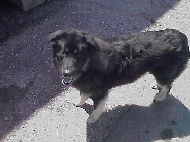
Uplifted sediments of shale, sandstone and limestone. Had a snack here
and also met up with a friendly dog. I had to work hard to insure he
didn't follow me to Nipigon.
Stopped in Nipigon for a late lunch and also to visit the tourist information center. Here I heard of a motel 25 miles ahead.
After Nipigon the road split into #11 which heads north and #17 which goes
along the lake. Apparently, the northern route is flatter and is thus
preferred by trucks because it takes less fuel. The southern route is
more scenic, though I was also warned several times about the hills.
 The initial eight miles of this road were very nice: reasonable shoulders
and well paved. Saw a moose here. After that I encountered a ten mile
stretch of road
construction. Lots of corrugated surface and occasional narrow sections.
The route also had several small hills to climb, which then had nice
views of the lake. 28 miles past the junction I came to the Gravel River
motel and a good stopping point for the day.
The initial eight miles of this road were very nice: reasonable shoulders
and well paved. Saw a moose here. After that I encountered a ten mile
stretch of road
construction. Lots of corrugated surface and occasional narrow sections.
The route also had several small hills to climb, which then had nice
views of the lake. 28 miles past the junction I came to the Gravel River
motel and a good stopping point for the day.
![]()
Mitten weather starting out. At mile 4 I started climbing the backside of the Caver's Cove hill. Put the bicycle into low gear and slowly climbed up. Nice view of the lake as I was going up. Down on the other side I descended past Caver's Cove. I passed a restaurant advertising "Minnows/Home Cooking" and wondered if it only seemed strange to me.
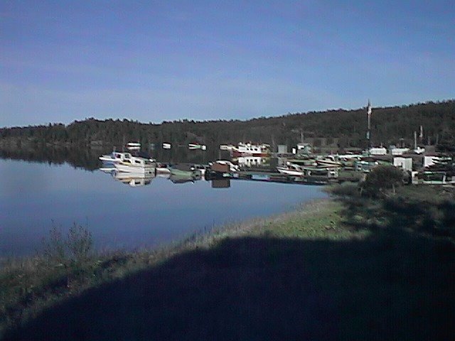 Took the turnoff into Rossport at mile 16. A beautiful harbor with several
boats. Unfortunately nothing was open. The next stretch went within 20 feet
of the lake before climbing up the next hill past Rainbow Falls. Several
rolling hills before breakfast in Schreiber.
Took the turnoff into Rossport at mile 16. A beautiful harbor with several
boats. Unfortunately nothing was open. The next stretch went within 20 feet
of the lake before climbing up the next hill past Rainbow Falls. Several
rolling hills before breakfast in Schreiber.
Terrace Bay had a nice visitor info center. The town was named for the geological terraces from dropping water levels in Lake Superior. After Terrace Bay was forty miles without major towns. This next stretch had several more rolling hills which made for pretty views of the lake. Reached Marathon about five. Along the way I saw one moose dashing across the road with two young moose in tow.
Marathon is a town of 5500 people. All four motels were full. I waited
at one and called around and eventually found an extra room they were
cleaning. Good, since the weather clouded over and it was almost mitten
weather again. At dinner
I met a Dutch couple visiting the USA and got some more road info.
![]()
 The day started out dreary and wet. Light drizzle starting out.
Stopped at the truck stop heading out of town on my way out. The
shoulders were narrow on this next section and slightly dished as
"rain troughs". The trough and the spray from passing transports meant
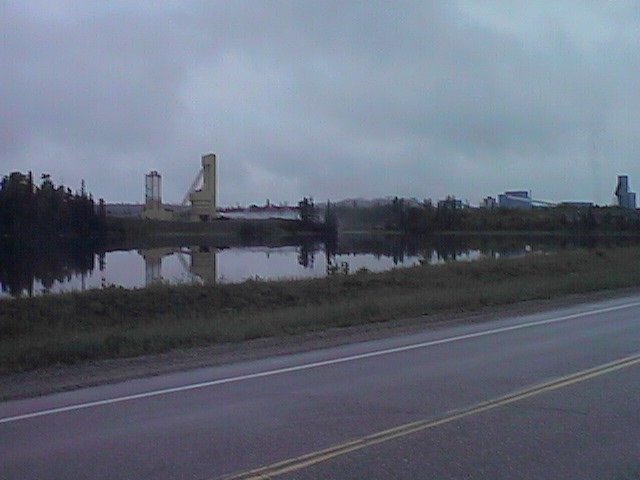
I got fairly wet going out. At mile 24 I passed by the Hemlo Gold mines
shown on the picture.
The day started out dreary and wet. Light drizzle starting out.
Stopped at the truck stop heading out of town on my way out. The
shoulders were narrow on this next section and slightly dished as
"rain troughs". The trough and the spray from passing transports meant
I got fairly wet going out. At mile 24 I passed by the Hemlo Gold mines
shown on the picture.
Road construction at mile 27. Eight miles of gravel road. I quickly became lightly speckled in brown from mud mistings of passing transports. In one stretch they were spreading loose gravel which made it a little more difficult. Luckily it stopped fairly quickly and there was a store on the other side where I could clean up. By now the rain had also stopped.
In this part of Canada distances appear to be measured in minutes and not miles. For example, the answer to "how far to..." might be thirty minutes. Along this next stretch my odometer stopped working, so now I was measuring in minutes (and hours) too. I got up to 38.4 miles and then didn't progress. Hopefully just got wet.
Trucks! After mile 35 the shoulders went away. Today there were three occasions where I heard a loud truck honking behind me. I didn't have a rear view mirror, so I would instinctively dive to the gravel shoulder. Usually they could have easily passed, but I was rather safe than flat.
 Reached White River at mile 55. This town is the home town of Winnie the
Pooh. A Canadian soldier, Captain Harry Colebourn, purchased the bear
"Winnipeg" and brought him overseas during the first world war. The bear was
given to the London zoo when Colebourn's unit was called to the front lines.
The bear was a big hit at the zoo and then served as inspiration for
A.A. Milne's stories. There is a large statue of Winnie the Pooh and also
an annual festival.
Reached White River at mile 55. This town is the home town of Winnie the
Pooh. A Canadian soldier, Captain Harry Colebourn, purchased the bear
"Winnipeg" and brought him overseas during the first world war. The bear was
given to the London zoo when Colebourn's unit was called to the front lines.
The bear was a big hit at the zoo and then served as inspiration for
A.A. Milne's stories. There is a large statue of Winnie the Pooh and also
an annual festival.
After White River I cycled through the forest for ~25 miles just past
Obatanga Park and to a good stopping point for the day.
![]()
Got off to a nice early start. Luckily my odometer was working again. Cool cycling through forest and resort area. First fifteen miles had a smooth newly paved road. This was followed by a road that really needed to be repaved. Breakfast at mile 25 and then stopped in at Wawa at mile 30. On the way I saw a group of eight cyclists riding in matched yellow jackets and being trailed by a police escort with flashing lights. Found out later that this was part of a relay team of Montreal police officers cycling from Montreal to Calgary at a rate of 500km per day.
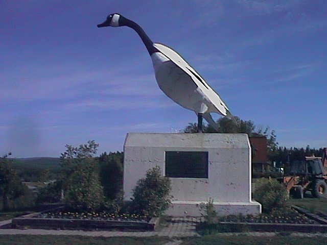 Wawa means "wild goose" in a local Indian dialect. Just outside town
they have a twenty foot large metal goose. In Wawa I stopped in for
lunch provisions. I also encountered a group raising money and awareness
of breast cancer: "Relay to Recovery". They were staging a foot/cycle
relay from St. John's, Newfoundland to Vancouver, British Columbia. Later
in the morning I cheered as a runner passed (though at that precise moment
I was slogging up the hill and he was running downhill). I also put in a
small donation.
Wawa means "wild goose" in a local Indian dialect. Just outside town
they have a twenty foot large metal goose. In Wawa I stopped in for
lunch provisions. I also encountered a group raising money and awareness
of breast cancer: "Relay to Recovery". They were staging a foot/cycle
relay from St. John's, Newfoundland to Vancouver, British Columbia. Later
in the morning I cheered as a runner passed (though at that precise moment
I was slogging up the hill and he was running downhill). I also put in a
small donation.
 Eight miles from Wawa is the start of Lake Superior Provincial Park.
Pretty forest and lake scenery and also several campgrounds. There is also
a day train from Sault Ste. Marie to the park, "Agawa train" that is well
worth the while (did this five years ago). Through the park was also where
I encountered several long hills.
Eight miles from Wawa is the start of Lake Superior Provincial Park.
Pretty forest and lake scenery and also several campgrounds. There is also
a day train from Sault Ste. Marie to the park, "Agawa train" that is well
worth the while (did this five years ago). Through the park was also where
I encountered several long hills.
Mile 55 was the top of a hill and lunch at the ranger station. Following
that I pedaled
 downhill but upwind. Saw two groups of other cross-country cyclists today.
First was a group of four women who had started in Tobermory (~350 miles
away) and were making their way to Vancouver. Some miles later were two
men from Quebec going to Vancouver. The two Quebecois were very friendly
and we pulled over and compared route notes.
downhill but upwind. Saw two groups of other cross-country cyclists today.
First was a group of four women who had started in Tobermory (~350 miles
away) and were making their way to Vancouver. Some miles later were two
men from Quebec going to Vancouver. The two Quebecois were very friendly
and we pulled over and compared route notes.
At mile 77 I came to the shore again. For the next stretch the road would
climb over a hill and then descend. Repeating this a number of times.
Mile 90 was a brief break at the first restaurant in 57 miles. After that
I went up the backside of a large hill (Montreal River hill) before descending
and stopping for the day.
![]()
 At mile 18 I figured it out. Winds were from the SSE and I had been
cycling in the shelter of the wind. I rounded the bend and then came into
gusty headwinds. This slowed things down a little and was a good excuse for
breakfast at mile 25. Several small motels along the shore here.
A few miles further was a large "First Nation" Agawa Canadian Carver
store. Apparently First Nation is the term used to refer to native
settlements. They don't charge the 7% GST and 8% PST so sometimes things
are a little cheaper there.
At mile 18 I figured it out. Winds were from the SSE and I had been
cycling in the shelter of the wind. I rounded the bend and then came into
gusty headwinds. This slowed things down a little and was a good excuse for
breakfast at mile 25. Several small motels along the shore here.
A few miles further was a large "First Nation" Agawa Canadian Carver
store. Apparently First Nation is the term used to refer to native
settlements. They don't charge the 7% GST and 8% PST so sometimes things
are a little cheaper there.
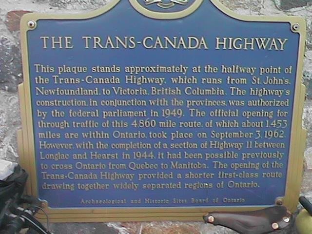 At the Chippewa River was a small plaque commemorating the
trans-Canada highway and marking the halfway point between Vancouver
and St. John's.
At the Chippewa River was a small plaque commemorating the
trans-Canada highway and marking the halfway point between Vancouver
and St. John's.
Many small cottages and camps. Flat terrain. Outside mile 50 I was going
directly into the wind. Shortly thereafter started climbing a hill
away from the bay. Climbed up and over to route 552 where there was another
large hill before Heyden. A local group was holding a car wash but wasn't
getting much business. I declined to have the bicycle washed. I'm pretty
sure there are still bits of Manitoba dust on the bicycle (don't know about
the Yukon or BC anymore).
After Heyden downhill and upwind. Got in around 3pm
which was a little later than I'd expected. Wind makes a difference.
![]()
 I've noticed a gradual increase in the amount of French signage.
Throughout Canada, French has always appeared on federal property and on food
packaging. In Manitoba, I saw the first French road signs and now in
this part of Ontario they are more prevalent. The billboards are still
almost exclusively English and still report miles at least as often as
kilometers.
I've noticed a gradual increase in the amount of French signage.
Throughout Canada, French has always appeared on federal property and on food
packaging. In Manitoba, I saw the first French road signs and now in
this part of Ontario they are more prevalent. The billboards are still
almost exclusively English and still report miles at least as often as
kilometers.
Breakfast at mile 16 at a small cafe with a friendly cook/waitress/owner/etc. This was the first year she had owned the place. After breakfast, the road became double lanes, but the shoulder went away. At one point I thought something must be rubbing because I kept going slower and slower. When I saw "Hilltop Store", I figured it out. This fog was deceptive. I believe this area had more small farms and smelled at least one dairy farm.
At mile 29 my odometer decided to stop working for the day. Too much
humidity.
 Shortly thereafter the town of Desbarats was having their annual pike
derby. Over 100 registrants trying to catch the largest northern pike.
Last year's winner was 8 pounds but they had been caught up to 20 pounds.
Proceeds went to the local fire department.
Shortly thereafter the town of Desbarats was having their annual pike
derby. Over 100 registrants trying to catch the largest northern pike.
Last year's winner was 8 pounds but they had been caught up to 20 pounds.
Proceeds went to the local fire department.
Bruce Mines was named for the copper mining. Nice small main street and then I was through town. Reached Thessalon just in time for it to start raining. 55 miles and time for lunch anyway. I stopped in at the local restaurant/motel. It cleared up, or else they would have had another motel guest. Of course once I got out of town it rained lightly for a bit. Luckily it stopped.
Fog lifted after lunch. Still overcast with a light tailwind developing.
Also a few small hills to climb over. Came through small towns of Sowerby
and Iron Bridge. Just as was a mile out of Iron Bridge it started pouring.
Nice thunderstorm for half a dozen miles. Luckily the road had shoulders
again
and luckily there was no lightning. It stopped by the time I got to
Blind River. At population 3900 this was the largest town I'd see for a
while.
![]()
After breakfast the fog lifted. Passed through another First Nation community. Some gentle hills here, but nothing too bad. The town of Massey had a nice main street with Canada flags and signs for a local marathon. Some road construction and I was at Espanola at mile 62. Only eleven but the tailwinds had helped. Thought briefly about letting the winds continue to blow me towards Sudbury but kept to the original plan.
 Immediately after Espanola the terrain changed. Lots of short sharp hills.
Up and down. Also lost my tailwind as I turned south. Many small lakes
in between the hills and also signs for resorts. Went a lot slower
and stopped ten miles further at Whitefish falls.
Immediately after Espanola the terrain changed. Lots of short sharp hills.
Up and down. Also lost my tailwind as I turned south. Many small lakes
in between the hills and also signs for resorts. Went a lot slower
and stopped ten miles further at Whitefish falls.
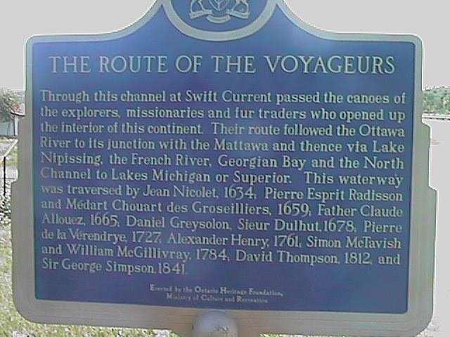 After Whitefish falls the hills became smaller. At Birch Island passed
a large plaque commemorating a place Franklin Delano Roosevelt had spent a
week fishing in 1943. Also a sign describing routes of the early explorers.
Around three and I was in town of Swift Current.
After Whitefish falls the hills became smaller. At Birch Island passed
a large plaque commemorating a place Franklin Delano Roosevelt had spent a
week fishing in 1943. Also a sign describing routes of the early explorers.
Around three and I was in town of Swift Current.
![]()
 The weather turned out much better than expected. Started cycling in
time to see a beautiful sunrise over the bay. The moon was close to full
and was also still up. Cool morning air, light traffic and almost no wind.
One long hill at Sheguiadah, but otherwise fairly flat. Some farms along
the way with beef cattle. Nice old cemetery at Hilly Grove. Many
wildflowers out and in bloom.
The weather turned out much better than expected. Started cycling in
time to see a beautiful sunrise over the bay. The moon was close to full
and was also still up. Cool morning air, light traffic and almost no wind.
One long hill at Sheguiadah, but otherwise fairly flat. Some farms along
the way with beef cattle. Nice old cemetery at Hilly Grove. Many
wildflowers out and in bloom.
At mile 21 the restaurant in Manitowaning was closed. At this point I realized I was making very good time and could make the 9:10am ferry if I pushed (instead of mosying to the 1:30pm ferry and poking through South Baymouth in the rain as I'd planned). A few more hills, with more sedimentary rocks. Still nice easy going on the road. Reached the ferry at mile 40 with plenty of time to spare.
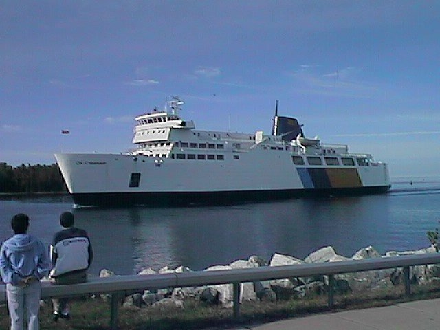 Stowed my bicycle down in the car deck and went up to the ferry cafeteria
for breakfast. Ate breakfast as we sailed over to Tobermory. As we neared
Tobermory we passed many small islands that are part of Fathom Five National
Marine Park. Tobermory bills itself as the scuba capital of Ontario.
Stowed my bicycle down in the car deck and went up to the ferry cafeteria
for breakfast. Ate breakfast as we sailed over to Tobermory. As we neared
Tobermory we passed many small islands that are part of Fathom Five National
Marine Park. Tobermory bills itself as the scuba capital of Ontario.
Off the ferry the road leaves Tobermory fairly quickly. Many wildflowers and
forests along the road, but otherwise a straight road through the forest.
Many turnoffs to cottages and resorts. Around Ferndale the land opens
up more, with cattle (signs saying Charalais) and some planted fields.
Gently rolling hills. The forecast headwinds stayed as crosswinds so I
continued on until Wiarton. A few more miles than expected.
![]()
Roads in southern Ontario are surprisingly poor. Gravel shoulders are the norm and frequently the edge of the road was cracked or crumbling. To the chagrin of some drivers, this meant riding a bit further into the road. Fortunately most folks were polite and gave me plenty of room. Heavier traffic did mean concentrating a bit more on the road and less on the scenery.
 From Wiarton southbound traffic was fairly heavy going all the way into
Owen Sound. Breakfast at mile 16 outside Owen Sound. A steep descent
to the center of the city, followed by a climb up the other side. There
were farms, some with cattle or horses but it was difficult to see exactly
what was being farmed.
From Wiarton southbound traffic was fairly heavy going all the way into
Owen Sound. Breakfast at mile 16 outside Owen Sound. A steep descent
to the center of the city, followed by a climb up the other side. There
were farms, some with cattle or horses but it was difficult to see exactly
what was being farmed.
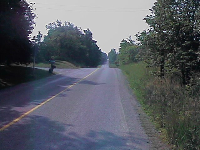
At mile 28 the road split. It became much quieter and also somewhat hillier. It wasn't that the land was particularly hilly, just that the road went straight over the drainages.
It was already hot and humid. My shirt was completely soaked with sweat. I went through more than half a dozen water bottles today and several drinks. Every ten miles or so I'd stop in somewhere to cool off and refuel. Fortunately neither forecast headwinds or thundershowers appeared.
 This route paralleled a rail line which was no longer active. Lunch was
at Markdale and the next rest stop was Proton Station twelve miles down
the road. It continued to be sweltering hot. I believe there were
respiratory alerts and smog alerts issued for Toronto today.
This route paralleled a rail line which was no longer active. Lunch was
at Markdale and the next rest stop was Proton Station twelve miles down
the road. It continued to be sweltering hot. I believe there were
respiratory alerts and smog alerts issued for Toronto today.
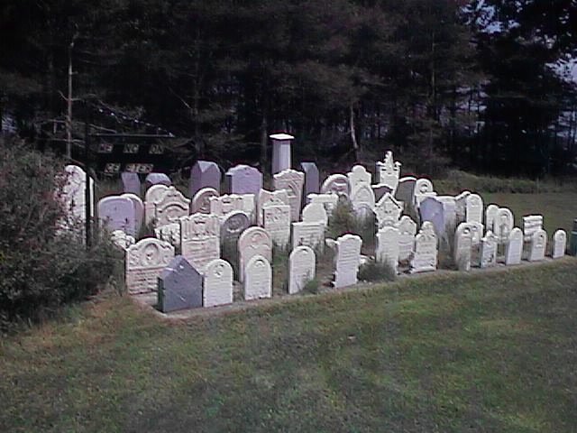 Passed several small graveyards with all the gravestones clustered together.
Tailwinds started picking up as I neared Shelburne. Hooray! This town had
signs up as the "Old Time Fiddling Capital of Ontario" and signs for the
annual fiddling contest. I continued four
miles east to Primrose and then I faced a choice for the end of the day:
Orangeville 15 miles south or Alliston 17 miles east. Locals confirmed
there were motels in both towns (under my ask three locals plan...).
Tailwinds looked most inviting towards Alliston, though there were road
construction signs. I decided to go with the wind. Road
shoulders were poor and locals were impatient, but made good time to Alliston
on #89. Stayed in this town whose claim to fame is potatoes.
![]()
A surprising amount of traffic as I left Alliston. Climbed a medium sized
hill outside Cookstown. Not too far from #400, must be commuter traffic
this far out. Zig zagged my way to Bradford before stopping for breakfast
at mile 21. After breakfast the next ten miles continued busy, but then
as I passed #404, I suddenly found myself out in quieter country roads.
 This region continued somewhat hilly. Winds were strong enough that
I contemplated letting them blow me to Peterborough. Saw a large variety
of crops today. Some "city crops" such as sod farms, nurserys or christmas trees.
Also wheat, corn, potatoes, canola and hay. Saw both beef cattle and
dairy cattle. Also several small "u-pick" farms with strawberries or
apples.
This region continued somewhat hilly. Winds were strong enough that
I contemplated letting them blow me to Peterborough. Saw a large variety
of crops today. Some "city crops" such as sod farms, nurserys or christmas trees.
Also wheat, corn, potatoes, canola and hay. Saw both beef cattle and
dairy cattle. Also several small "u-pick" farms with strawberries or
apples.
Slowly went cross the wind and hills on #31. Downwind on #5 to Claremont. I could tell that I was still outside a larger urban area since there were areas with subdivision homes and also some computer stores. The wind helped get me to 65 miles before lunch at Brooklin.
From Brooklin, I made my way to #2 and was suddenly in urban Oshawa. Slowly became less urban which was nice because I could get more tailwinds. At mile #87 I noticed my rear tire suddenly rubbing. The sidewall of the tire was tearing out. I parked under a nearby tree and replaced the tire with my spare. This tire had lasted since Saskatchewan and the rubber tread was completely worn out in places.
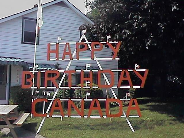 I've noticed more Canadian flags and also some decorations up for the
upcoming Canada Day on July 1st. I also haven't seen much French on road
signs anymore.
I've noticed more Canadian flags and also some decorations up for the
upcoming Canada Day on July 1st. I also haven't seen much French on road
signs anymore.
Last fifteen miles were very rural. One stretch of road construction before
coming through Port Hope. At 105 miles a long but not particularly difficult
day.
![]()
Nice and cool and overcast as I started out. The road even had a paved shoulder to Cobourg! The steepest hills I encountered were the railroad overpasses. These lines were active and I saw several freight and passenger trains. Both Port Hope and Cobourg are nice ~15000 person towns with an old city center. Cobourg was still sleeping when I came through.
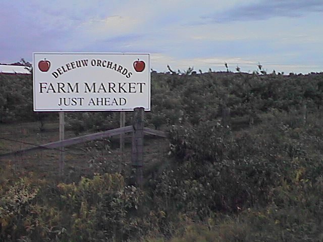 This is apple country. Many orchards and trees. Also some strawberries and
other local fruit. After Cobourg the road became quiet and rural and a
nice route for cycling. Passed through Colbourne, one of the first towns
I've seen with a historic "square" in the center of town. Brighton was
a little larger than Colbourne and then it started becoming more urban
again through Trenton and Bellville. Bellville had a large Canadian Air
Force base and training center.
This is apple country. Many orchards and trees. Also some strawberries and
other local fruit. After Cobourg the road became quiet and rural and a
nice route for cycling. Passed through Colbourne, one of the first towns
I've seen with a historic "square" in the center of town. Brighton was
a little larger than Colbourne and then it started becoming more urban
again through Trenton and Bellville. Bellville had a large Canadian Air
Force base and training center.
 Once past Belleville, the road became more rural. Less apples, but still
many farms. Made it to mile 73 before stopping for lunch in Napanee.
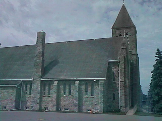
Very nice old church outside Marysville.
After lunch slowly made my way towards the "big city". Traffic picked
up as I entered Kingston. While it was still early, decided to stop and
have an easy day today.
Once past Belleville, the road became more rural. Less apples, but still
many farms. Made it to mile 73 before stopping for lunch in Napanee.
Very nice old church outside Marysville.
After lunch slowly made my way towards the "big city". Traffic picked
up as I entered Kingston. While it was still early, decided to stop and
have an easy day today.
![]()
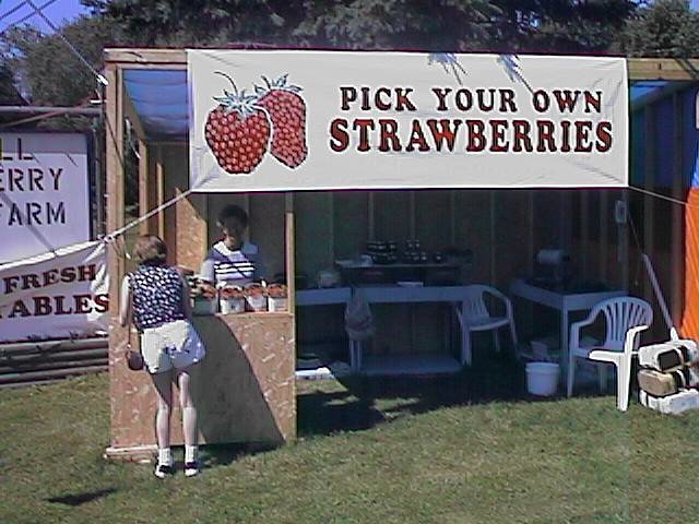 Ganaque was a smaller town billing itself as a gateway to the 1000 islands.
Also a good spot for breakfast at mile 21. After Ganaque the road became
nice and rural. Stopped at this strawberry stand, just for a picture.
Many of the area farms had just cut their hay and were either drying it
out or had bales/rolls out to be picked up.
Ganaque was a smaller town billing itself as a gateway to the 1000 islands.
Also a good spot for breakfast at mile 21. After Ganaque the road became
nice and rural. Stopped at this strawberry stand, just for a picture.
Many of the area farms had just cut their hay and were either drying it
out or had bales/rolls out to be picked up.
 After Mallorytown, the road went over #401 and then right along the
St. Lawrence River. The route for the rest of the day closely paralleled
the river with many good views. Just past Maitland I came past a large
DuPont chemical plant. I stopped to take this picture. The security
guard came out, told me not to take pictures. He also eyed me suspiciously
and asked if I was with Greenpeace. Nope, although it did make me a bit
more curious what Dupont manufactures in Maitland.
After Mallorytown, the road went over #401 and then right along the
St. Lawrence River. The route for the rest of the day closely paralleled
the river with many good views. Just past Maitland I came past a large
DuPont chemical plant. I stopped to take this picture. The security
guard came out, told me not to take pictures. He also eyed me suspiciously
and asked if I was with Greenpeace. Nope, although it did make me a bit
more curious what Dupont manufactures in Maitland.
Stopped at 68 miles in Johnstown for lunch. At lunch met Eber, another
cyclist. He was on a three week trip from Buffalo east to Quebec City and
then back. We cycled the next thirty miles together. First time with another
touring cyclist and also a nice way to keep pace for a while.
 The route continued right along the river. Stopped briefly in Morrisburg
where a man came up and handed me a Morrisburg pin. Introduced himself as
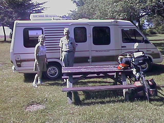
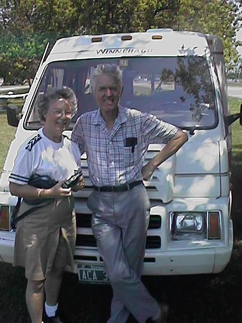
the Mayor of the town. Shortly past Ingleside I met my parents at the
Long Sault Parkway. They had come up from Vermont for a few days along the
way.
The route continued right along the river. Stopped briefly in Morrisburg
where a man came up and handed me a Morrisburg pin. Introduced himself as
the Mayor of the town. Shortly past Ingleside I met my parents at the
Long Sault Parkway. They had come up from Vermont for a few days along the
way.
![]()
 Left early again. My parents were gracious to pack up the tent & sleeping
bag, and more importantly, carry them in the camper for the first part of
the day. Lighter weight and tailwinds meant for a good day today for
distance. The first part of the route continued along the St. Lawrence.
Many small houses and boats along the water. Made quick progress to
Lancaster at mile 31 where I stopped for breakfast.
Left early again. My parents were gracious to pack up the tent & sleeping
bag, and more importantly, carry them in the camper for the first part of
the day. Lighter weight and tailwinds meant for a good day today for
distance. The first part of the route continued along the St. Lawrence.
Many small houses and boats along the water. Made quick progress to
Lancaster at mile 31 where I stopped for breakfast.
 After Lancaster the route went diagonally across. I had picked this route
in part as a method of avoiding most of the madness of Montreal. It was
rural with farms. Some wheat, some corn and some hay. The shoulder was
often less than a foot wide, but traffic was light.
After Lancaster the route went diagonally across. I had picked this route
in part as a method of avoiding most of the madness of Montreal. It was
rural with farms. Some wheat, some corn and some hay. The shoulder was
often less than a foot wide, but traffic was light.
 There is a saying that corn should be knee high by the fourth of July.
I don't know if this holds for Canadian corn (perhaps by Canada day?),
but the corn in the fields passed the test.
There is a saying that corn should be knee high by the fourth of July.
I don't know if this holds for Canadian corn (perhaps by Canada day?),
but the corn in the fields passed the test.
I passed through the town of Van Kleek Hill and then had a good descent to the Ottawa River. I'm not certain where all the climbing came from, since I didn't notice much on the way up. I came to the river and by the bridge close to noon. Here I met my parents. We modified our original plans slightly. They noticed problems with the camper transmission and were cautious about starting back. While I had 70 miles, it was early and making good time, so I wanted to push on. We first had a nice lunch at the bridge.
Over the river and to Quebec! Ontario is a large province and I was finally across! The other side didn't look that different, except that English text was the vast minority "Vente Garage Sale". Shoulders were still narrow, except here traffic was heavier. I continued with a nice tailwind though.
Cycled through Lachute and made my way to St. Antoine. Mileage was 106 when I reached the city. Took me another six miles to find a motel. First I tried my "motel intuition", but that didn't help. I asked for directions three times, but we had difficulty understanding. Finally I got clear directions and found a place for the night.