

August 1st-10th, 2001
Map 21
August 1st; Rest day in Port Hedland

Today
a rest day to see some of Port Hedland. This morning I took a tour of the
BHP Iron Ore facilities. BHP is the world's second largest iron ore
shipper. Last year, 65 million (metric) tons of ore were shipped from Port
Hedland. Facilities at Port Hedland do some sorting and crushing, but are
primarily for transferring ore from rail to ships. The numbers involved
are large.
Most of the ore is mined at Mount Whaleback, 426 km south of here. It
is crushed at the mine and loaded onto ore cars. Each railroad car holds
115 tons. Railroad cars are assembled into 2.6 km long trains, with 240
ore cars and four locomotives. Approximately nine trains arrive at Port
Hedland per day. On June 21st this year, BHP created the world's largest
train, some 7.3 km, while testing some new locomotives.

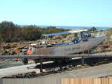 At
Port Hedland, trains are split and then run through "dumpers" which
tip over 2 or 3 cars at a time to dump contents onto conveyor belts. Ore
is stockpiled and may be sorted and crushed before loading. There is
berthing space for two giant (up to 250,000 ton) ships to load. Port
Hedland is the only Australian port to have two such berths. Loading of
ships is an almost continuous operation, with other ships waiting
offshore. Today seven ships were waiting. About 40% of the ships go
to Japan, with Korea and China also important markets. The remainder go to
Taiwan, Europe or elsewhere in Australia. Today a ship was loading for
Japan and one for China. It takes 14 days to sail to Japan and 35-40 days
to sail to Rotterdam via the Cape of Good Hope.
The tour gave a good idea of the scale of everything with huge piles of iron
ores, giant ships, conveyor belts, dumpers, etc. We also saw a salt ship,
headed for Taiwan, being loaded. Across the harbor is a new "Hot
Briquetted Iron" plant. This plant forms iron ores into 500g
briquettes for use in electric arc steel furnaces. The plant is still new,
but expects to ramp to capacity of 2.5 million tons of briquettes.
I took a harbor tour in the afternoon. Gave a good chance to see the
ships up close, loading iron ores and salt. I also visited the small
museum that showed original harbor masters quarters.
Otherwise, downtown Port Hedland is small and even boasts the shortest main
street in Australia. The old town was built on a small island that was
connected to the mainland by a causeway. In the 1960s, the iron ore
facilities were first developed. This caused town population to boom from
1200 to 12000. There wasn't enough room on the island for the growth in
town size, so most of the people and many of the shops are in a satellite
community, South Hedland, some 15 km south of here.
Today helicopter activity as a fisherman was lost at sea some 85 km out, and
presumed dead. Port Hedland has also been in Australian news due to a
detention center for illegal immigrants and recent riots/jailbreaks they've had.
Nice strong easterly winds today. Hope they last long enough before I
"turn the corner" and head more southwards again.
0 km today, 13095 km cumulative.
August 2nd; Port Hedland to Whim Creek
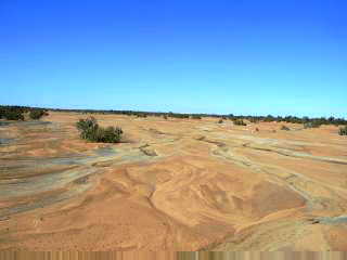 Easy
ride today. Started against the wind coming out of Port Hedland. SE
winds with coastal wind warnings from Broome to Onslow today. Moderate
traffic between Port Hedland and South Hedland and not much after that.
Mostly flat open terrain with a few areas of bushes and trees.
After 6 km, walked my bike over the Redbank railroad overpass. Riding
again, stopped in South Hedland for brekky. At 42 km, was a turnoff to
Newman and the shorter route to Perth. Most traffic however chooses the
coastal route.
After 52 km, I noticed a cyclist up ahead. No panniers, tent or other
long haul gear. Riding a mountain bike with nobby tires, slightly rusted
wheel and wobble on the back rim. Stu was riding 190 km to Roebourne
today. He hadn't ridden a bicycle since Christmas but made a wager with
friends at work. He fixed up his son's bike and started this
morning. If he made it to Roebourne, he'd earn ~$600 and give it
to charity. I slowed down, Stu sped up, and we cycled together for 20 km
or so. Stu worked on natural gas operations at the BHP Hot Briquette
plant.
We crossed the Yule River after 57 km. Wide banks but only a trickle of
water. After 87 km, came across a broken down red station wagon.
Broken cooling system (fan belt or perhaps water pump...wasn't quite
clear). Driver and his passenger were commiserating with a beer before
driving again. I passed them stopped at 90 km mark and stopped again at
102 km.
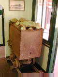
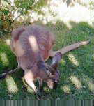 After
100 km, road came around interesting red outcroppings and over a low divide at
112 km. Came to Whim Creek or a late lunch. Whim Creek was nice
place with wildlife sanctuary for birds and kangaroos. The hotel was hit
by category 5 cyclone in December 1999. A copper mine had operated in this
area, but shut down because 2.31% copper was not economically viable to recover.
Guys with broken red station wagon arrived after I did, arguing whose half of
the car had broken down. A bit of a comic duo. Stu arrived an hour
later, sore and deciding to stay here tonight as well.
117 km today, 13212 km cumulative.
Map 22
August 3rd; Whim Creek to Karratha
 Late
yesterday, Peggy and Justin arrived. They are cycling around Australia,
started in Brisbane on Easter Weekend and returning before Christmas.
There are at least six of us "all around Australia" cyclists in four
groups within a few days of each other southbound through WA...and at least
three other 2500+ km cyclists as well. Peak season! (Today in
Karratha, heard from the Bike Force bike shop that Bendan and Wendy may be in
Karratha as well, and Ben Carey stopped by).
Whim Creek is a nice pub. There were a few orphan kangaroos around
being nursed. The pub was heavily damaged in Cyclone John, a category five
storm that was an almost a direct hit on Whim Creek in December 1999.
Occupants survived by sheltering in a shipping container for 22 hours while the
roof was blown off and walls knocked over. December is definitely not
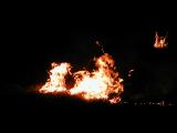
cycling season here. Last night, flames from bush fires could be seen
nearby, and also when I set out this morning.
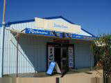
 Flat
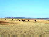
open grasslands without many trees. Fortunately, light winds. Saw
several kangaroos hopping along and more road kill than normal. Also more
road trains. Easy riding in cool morning air.
Crossed Sherlock River at 30 km with nice reflections. Turnoff to
Millstream and Karajini National Parks at 57 km and then into Roebourne at 83
km. The tourist info center in Roebourne is in the old Gaol (jail) and is
part museum. The rest of Roebourne was small with motel, gas station and
store. At the gas station was notice that Monday was holiday for Fenacling,
though folks at the gas station didn't know what it celebrated, perhaps the
queen?
Climbed over a small hill and left Roebourne behind. More traffic here
but still quick riding to the Karratha turnoff and then 6 km to town.
Karratha has a FeNaClNG festival this weekend which is a celebration of most
important products of the Pilbara: iron (Fe), salt (NaCl) and natural gas
(NG). Karratha has large natural gas fields and also iron.
Otherwise, a larger town with big shopping area and first McDonalds since
Darwin. Also Coles and Woolworths to restock for sparse regions coming up.
121 km today, 13333 km cumulative.
August 4th; Karratha to Fortescue River Roadhouse
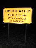
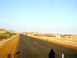 The
Pilbara has beautiful primary colors: golden yellow grasses, reddish rocky
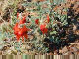
hills, blue skies with a slight haze. I'm also seeing a few more
wildflowers along the way. A few dusty green trees, but mainly in the
creek bottoms. Otherwise, one can see long distances across the
land. Fortunately, light variable winds and occasional gradual grades.
Left Karratha at first light (Happy FeNaClNG! and happy 101st to Queen
Mum!). A little complicated getting out the shopping center, but
eventually carried my bike over some medians.
Rode 6 km back to main road and then 8 km further to travel stop outside
town. The bus from Perth to Darwin was also stopped, so plenty of patrons
out. Bought some brekky and a newspaper, though left behind the real
estate, automotive and classified sections. On the road again!
 After
30 km was Miaree Pool, somewhat cloudy looking water...though more than I saw at
later river crossings. A crew that had been emptying trash and removing
road kill passed me, so didn't see road kill after that. Also, multiple
"oversized load" road trains coming the other way.
Around 70 km mark, road was a bit rougher with coarse chips, but overall
continued to have good roads. Made it to roadhouse in time for a late
lunch. Fortescue River itself was a string of pools and wasn't flowing.
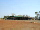
Still cleaning rooms, so waited in the cafe. This is one of the smaller
roadhouses I've seen. First opened in 1972 and under the same management
for the past 25 years. Traffic decreased somewhat when inland route via
Newman was opened (100 km shorter for truckies heading north of Port Hedland).
112 km today, 13445 km cumulative.
August 5th; Fortescue River Roadhouse to Nanutarra
Roadhouse
Tap water at Fortescue River Roadhouse had a bit of a taste to it.
However, since bottled water was even more expensive than petrol ($2.50/liter
vs. $1.10/liter), I filled up with a mixture of tap and bottled water.
I've avoided gatorade or other flavors since it seems to encourage things to
grow in my water bottles. Rivers in this area are not flowing. When
they have water, it is a chain of ponds. This was the case for Peter
Creek, Robe River and Cane River today.
Bushes increased in density and size as I rode today. Still a few
wildflowers, much spinifex grass and occasional rusty rock outcroppings.
Light winds, though more often tail wind than head wind. Less traffic than
past few days, though at least six caravans from behind gave me a friendly toot.
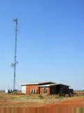
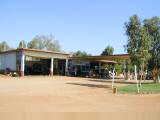 First
half hour of riding was still dark, but by the full moon. Peaceful and
quiet. Kept the speed down until daylight and then gently gliding
along. At 40 km was a turnoff to Pannawonica and also a large scoop from
some mining equipment. At 70 km, some caravaners passed and pulled off for
morning tea. I'd met them nine days before when leaving Broome. Nice
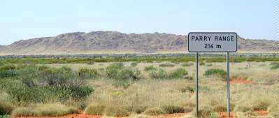
tail winds here for a while. After this, the route paralleled the Parry
Range. Arrived in mid afternoon. Water tastes better here.
Otherwise, nice to relax after a long ride.
162 km today, 13607 km cumulative.
Map 23
August 6th; Nanutarra Roadhouse to Giralia Station
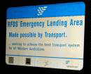
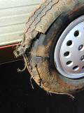 Strong
winds from SE and S made a tougher ride today. Started by moonlight again
at 5:30 am. Light wind, but it kept getting stronger through the
morning. After 10 km, the road widened and signs indicated that the
roadway was also an emergency airstrip for Royal Flying Doctors. Watch for
planes as well as road trains!
Still more scrub, though it got a bit smaller through the day. I
counted eleven "grid" crossings, but only ten cows. At each grid
crossing, I'd slow down and gently walk across with the bike. Probably
fine to ride over, but I wanted to avoid breaking a spoke with a big bump.
The first 50 km, the road occasionally turned into the wind. Slow going
to grind upwind. Most of the time, it was a cross wind. After 71 km,
a rest area and chance for a break. Talked with a caravaner who had blown
out two tires, used both spares and was now carefully riding to Carnorvan to get
better tires. Some of these caravaners stop for morning tea at rest areas.
 The
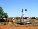
Yannarrie River had a few ponds with almost no water. After 85 km, a few
ridges to climb. Height was small, but road would occasionally turn into
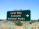
the wind. Finally after 112 km, came turnoff to Coral Bay and Exmouth.
As I turned the corner, I picked up a tail wind and could immediately shift up
three gears. Yeah! However, a bit worn from before so still kept it
slow.
The Burkett Road had been sealed three years ago, before that it was
gravel. Story I heard is that when the US closed down a base at nearby
Learmonth, they turned over buildings with understanding that proceeds from the
sale would go towards the road.
Nice ride, mostly with the wind for 42 km, where there was a turnoff to
Giralia Station and 4 km of gravel road. Giralia Station is a working
station with 25,000 sheep that supplements income with tourist accommodation.
Each sheep gives an average of 4 kg of wool per year. Water tastes salty, but
was able to get rainwater from the station. Delicious evening meal shared
with a "Design a Tour" group taking ten days to travel from Perth to
Broome.
158 km today, 13765 km cumulative.
August 7th; Giralia Station to Coral Bay

 Today
is census day. Even tourist visitors are asked to complete a form, so I
had a four page, 46 question form to complete. Wonder if they find any
people camping out in the bush. (August 8th West Australian showed a political
cartoon where they were knocking on Steve Fossett's balloon as he flew over
Australia).
Left Giralia Station early and made my way 4 km on gravel to Burkett
Road. Wind was blowing from SE again, so nice tail wind to blow me
along. It was kangaroo morning and I saw over fifty kangaroos. Some
I also heard as a "twang" when they slipped through the fence.
From the sounds, they may have marginal night vision (to see me or the fence)
since I heard more ugly fence collisions until it got light. A few hopped
along rather than crossing the fence, one of them for ~1500 meters or so.
He'd hop quicker than the bicycle, but then pause and go again. Also saw
two dozen sheep and several emus.
Tail wind made for nice travel until the last few kms where there were a few
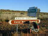
ridges to climb. Paused at the intersection at the Minilya-Exmouth road
for some breakfast crackers.
 Winds
still blowing from SE and hence towards Exmouth. I turned southwards to
Coral Bay. Next 52 km were a slow slog against the wind. The route
sometimes went on a ridge, nice view but worse for wind. Large termite
mounds looking like boulders in the fields.
I was happy to finally see the Coral Bay turnoff ahead! Turned more
away from the wind again and made good time the 12 km to Coral Bay. Mailed
next installment of photos and wandered around Coral Bay.
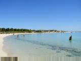
Coral Bay is an interesting place. Two huge caravan parks, some small
shopping centers, many tour operators and a nice sandy beach. Some of the
residents in caravan park look like they've been here for months. Coral
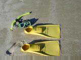
reef is accessible from shore and I've rented snorkel gear for tomorrow.
First, I have to complete that census form.
105 km today, 13870 km cumulative.
August 8th; Rest day in Coral Bay
 I've
been told that if I didn't get "trapped in Coral Bay, then you won't get
trapped anywhere in Australia". This certainly is a beautiful place,
with nice sandy white beaches and an easily accessible coral reef. Tides
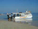
of 70 cm instead of 6 m at Broome. No pier, but instead a tractor service
to launch boats.
The Ningaloo Reef stretches from Exmouth southwards to about 60 km south of
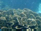
here. In Coral Bay are hard corals: browns, blues, greens and
purples. Also turtles, manta rays and about 500 species of fish.
Unlike the Great Barrier Reef off Queensland, one can swim from shore to the
reef. Ningaloo Reef is also one of few west coast reefs (another is in
Malaysia).
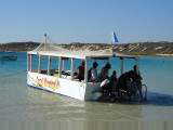
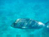 A
company had a package tour of an hour glass-bottom boat trip, an hour snorkeling
from the boat and then use of snorkel gear. I showed up at 8:30am and
signed up. Took two long snorkel swims in the morning, the boat trip and
snorkel in the afternoon and then another snorkel swim after that.
Wonderful! Particularly enjoyed following colorful fish and seeing a
variety of corals: staghorn coral, plate coral, cauliflower coral, etc.
Some colonies were huge.
Stocked up at the store, had seafood basket dinner and otherwise had a
relaxing day. From what I understand, prevailing winds will be headwinds
until Perth, so expecting some slow rides coming up. No wonder a cyclist
might get trapped in Coral Bay.
0 km today, 13870 km cumulative.
August 9th; Coral Bay to Minilya rest area
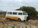 No
wind! Quickly got up and on the road to take advantage of calm
winds. Rode 12 km back to the coast road. Interesting how such
pretty white beaches are surrounded by reddish desolate looking terrain with
just a few bushes.
Back on the Minilya-Exmouth Highway and heading southbound. Road
surfaces occasionally bumpy, but otherwise good. At 47 km, crossed the
Tropic of Capricorn and into the temperate region again. Since entering
the tropics at Rockhampton, I'd had no rain. Expect this to change as a
sequence of fronts has been hitting Perth. Also been slowly getting
cooler.
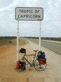
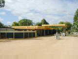 Some
roadworks south of the Tropic of Capricorn to widen the road and then back on
the main road at 90 km. Here I noticed how bumpy the Minilya-Exmouth road
had been, mostly as a contrast to a smoother and wider road.
Last 7 km brought me to Minilya Roadhouse. The roadhouse was full, so
camped at the rest area on other side of the (dry) Minilya River. In the
afternoon, strong coastal breezes. At one point, got into the tent to help
anchor it.
Later in the afternoon, Peggy cycled up. Her partner, Justin, had
developed knee problems riding against headwinds by Nanutarra Roadhouse and thus
taken a bus to Carnarvon. They had been one day behind, but caught up
again when I took my rest day. Peggy rode from Coral Bay as well today,
but started three hours after I did and caught more wind.
97 km today, 13967 km cumulative.
August 10th; Minilya rest area to Carnarvon
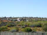
 A
dozen caravans last night, but amazing how everything quiets down early in the
evening. By 9 pm usually completely quiet. Every once in a while, a
noisy campervan arrives after dark, but fortunately not last night.
Back into early morning cycling to beat the wind. Made it 40 km in
complete calm before head winds started. Lots of scrub bushes along the
way, so not many views. A few low hills between 40 km and 60 km
marks. Saw several foxes, wild goats, sheep and many birds.
Yesterday some caravaners asked if I'd heard any "got-ta-get-drunk
birds". Nope. However, today I then noticed many bird calls
with four notes in decreasing tones.
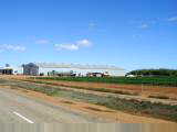
A few stations along the way including Boologooro Station, above left, at 80
km. Last 100 km were against the wind, but fortunately not too strong
today.
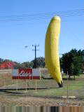
 At
120 km, signs indicated to get rid of contaminated produce before entering the
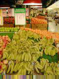
Carnarvon Horticulture District. I ate my orange just in case. The
Carnarvon district is irrigated from underground bores. The Gascoyne River
rarely flows above ground, but replenishes large underground reserves of
water. Saw lots of banana trees and also vegetables.
At 125 km, crossed a long single-lane bridge over the dry Gascoyne
River. Road turned westwards into afternoon sea breezes. Slowly made
my way to downtown Carnarvon. Definitely ready for a rest.
Walked around downtown a bit. Carnarvon has ~9000 residents which makes
it big enough town for a movie theater and senior center. However, still
small enough to have "visiting doctor" posters and also lacking a bike
shop. Carnarvon bananas are $1.69/kg at Woolworths. Outside town are
huge satellite disks described as "the former OTC Space Communication
Station." Not certain what OTC stands for.
139 km today, 14106 km cumulative.


![]() One
Year By Bicycle
One
Year By Bicycle